
If you’re from the east side of Cleveland, or in my case, the eastern suburbs, it’s impossible to miss the crater between downtown Cleveland and University Circle. These blocks fill what was once the heart of the city, and in fact my grandparents used to live in the E 70’s. If you drive around these neighborhoods now, you can catch a glimpse of the city that used to be, but you’ll probably a number of run down homes and empty lots next to a variety of nice and not so nice homes.
After I moved away from Cleveland, for college, and then grad school, and then work, I wanted to know if other cities had this vacuum, or if it was a phenomenon that rust belt cities felt alone.
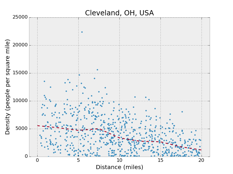
To look into this, I plotted the population densities of census tracts by the distance from what geolocators consider the center of town. This measure is of course no means perfect, as some cities have multiple population centers, but it does provide a way of comparing cities away from a map, allowing the scales to be more apparent.

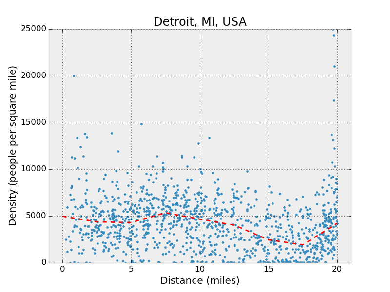
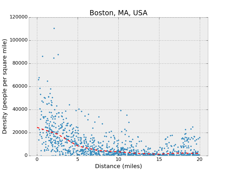
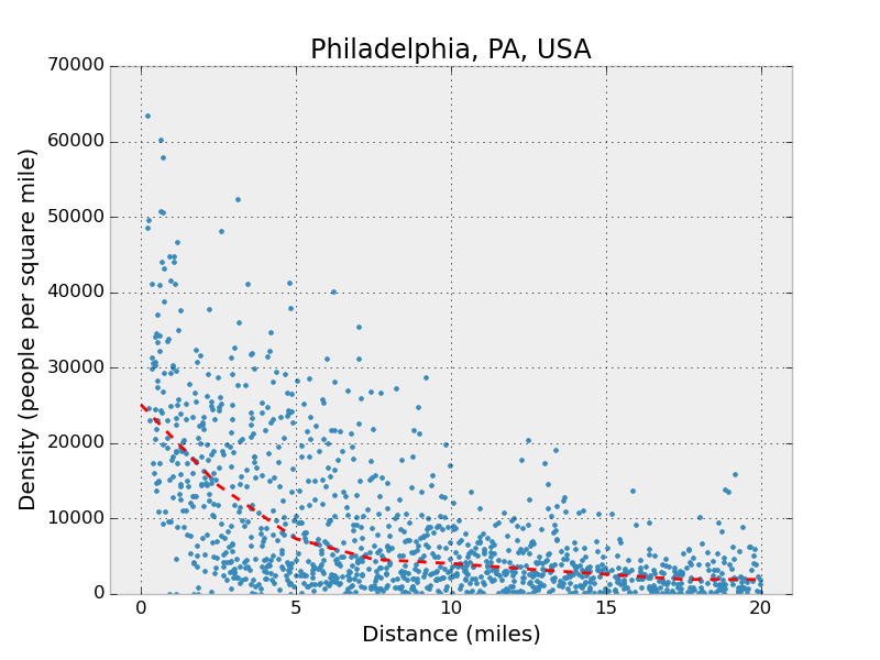
I’ll share here plots of Cleveland, Detroit, Boston, and Philadelphia, but you can see how dense the older cities, Boston and Philadelphia, are compared to Cleveland and Detroit. Whereas the former have nice population decays, with a few dense regions outside of the city, the latter show what happens when a city sprawls and then slowly fades away from the inside.
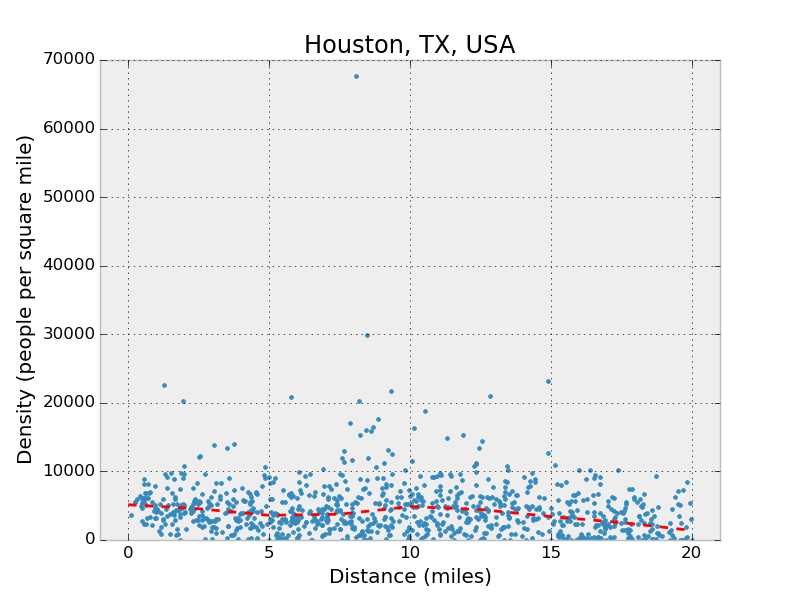
For good measure, I’ll include a plot of Houston, which looks a lot like Cleveland and Detroit.
I’ll write up some info on how I used Flask to create a web application, which you can see and use here, to all me to type any location in the United States and generate this plot on the fly, as well as to let other people use it. Check it out!